Interzone
The Interzone is the ex-urban, but no longer rural, landscape on the periphery of large cities. This body of work looks at the region around Toronto, from 2010 to the present, as a study of a global process of transformation of the urban periphery. The distinction between urban and rural becomes blurred in a development pattern characterized by low density residential neighbourhoods, a well-developed highway network for trucking and commuters, and retail activity relegated to auto-accessible malls: a kind of rolling frontier. A highly visible recent phenomenon is the buildup of an infrastructure of warehouses and trucking services to serve the ‘last mile’ of global supply chains, to facilitate the delivery of e-commerce goods. In Ontario these developments are expanding across precious farmland. The Interzone examines the six contiguous municipalities that make up the Greater Toronto Area, roughly 110 kilometres from west to east.

Housing developments northwest of Mississauga Rd. and Steeles Ave. West, Brampton, Ontario, Canada

Old town cemetary, Airport Road, south of Steeles Ave W, Brampton, Ontario, Canada

Louis St.Laurent Ave., near Thompson Rd. South, Milton, Ontario, Canada

Commercial development including Hilton Hotel, southwest corner of Warden Road and Hwy 7, Markham, Ontario, Canada

New housing development promotion, 209 Steeles Ave W, Brampton, Ontario, Canada

Housing development north of Steeles Ave., between Mississauga Rd. and Heritage Rd., Brampton, Ontario, Canada

Western Skies Way, McLauglin Rd., (or Mavis), Meadowvale, Mississauga, Ontario, Canada

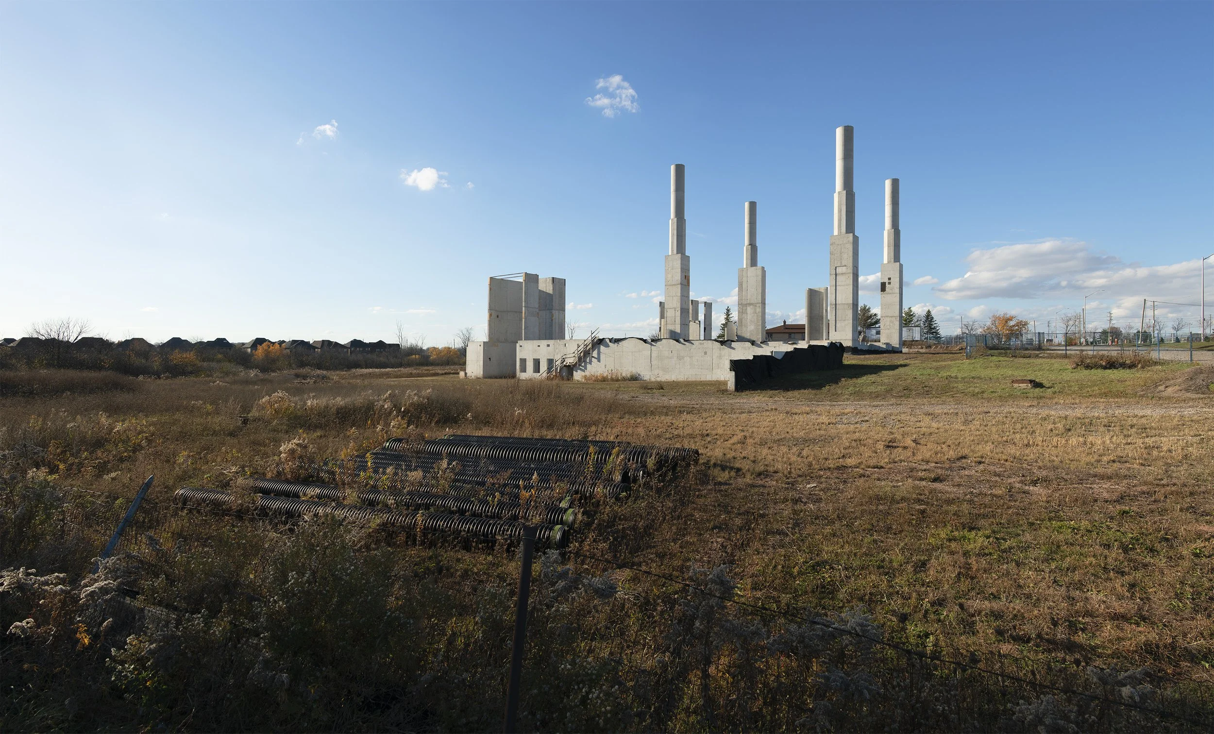
Land preparation for warehouses, near Zenway and Highway 427, Vaughn, Ontario, Canada

Frame for a warehouse under construction, near Zenway and Highway 427, Vaughn, Ontario, Canada, East Brampton, Ontario, Canada

Warehouse under construction, on Zenway Blvd., Vaughan, Ontario, Canada

Frame for a warehouse under construction, near Zenway and Highway 427, Vaughn, Ontario, Canada, East Brampton, Ontario, Canada

Warehouse near Zenway and Highway 427, Vaughn, Ontario, Canada, East Brampton, Ontario, Canada

Warehouse steel frame, 95 Parkhurst Square, Brampton, Ontario, Canada

New housing development promotion, 209 Steeles Ave W, Brampton, Ontario, Canada

The Humber River, view east into Humberwoods Park, from Humberwood Blvd., Rexdale, Etobicoke, Toronto, Ontario, Canada

view from Westney Road, Ajax, Ontario, CANADA

Emblem Logistics Inc., warehouses with trucks, village of Whaley's Corners, 7825 Winston Churchill Blvd, Brampton, Ontario, Canada,

Advertising for new housing development, north of Major MacKenzie Drive West, west of Hwy 400, Vaughan, Ontario, Canada

Mississauga Road, south of Steeles Avenue, Bramptin, Ontario, Canada

Warehouse under construction, 133 Milani Blvd, Vaughan, Ontario, Canada

Bramalea GO station, 1713 Steeles Avenue, Bramalea, Ontario, Canada

Ram Mandir Hindu Temple, 270 Export Blvd., (Derry Rd. east of Hurontario St. w. of Kennedy Rd., Mississauga, Ontario, Canada
Jame Masjid Oakville : Noor-UL- Haram, under construction, 2478 Ninth Line, Oakville, Ontario, Canada

Cathedral of the Transfiguration, Cathedral City, Markham, Ontario, Canada

Warehouse on Runway Road, Woodbridge, Vaughan, Ontario, Canada

Warehouses at Winston Churchill Blvd. at Hwy 401, Mississauga, Ontario, Canada

Site of planned expressway, Huntington Rd, north of Nashville Rd., Kleinburg, Ontario, Canada

Warehouse, 20 Production Rd., Brampton, Ontario, Canada
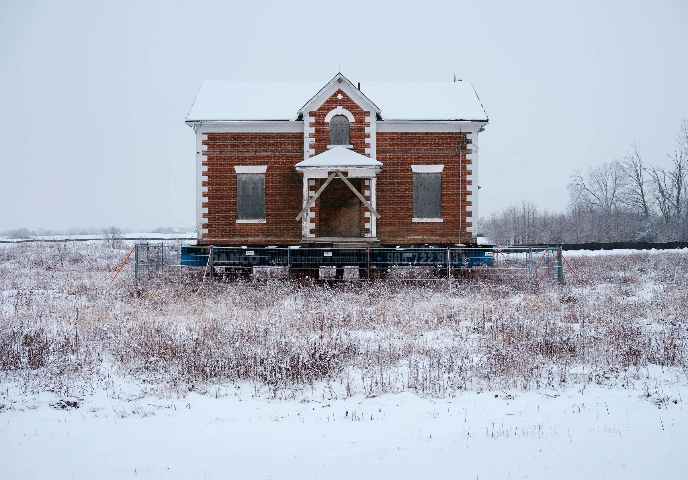
Original farmhouse being stored for relocation in new development, Coleraine Dr., Bolton, Ontario, Canada,

Land being prepared for development, Fifth Line, north of Britannia Rd., Milton, Ontario, Canada

Very large Walmart warehouse under construction, Vaughan, Ontario, Canada

Warehouse construction, James Snow Parkway South, Milton, Ontario, Canada

Warehouse construction, near completion, James Snow Parkway, Milton, Ontario, Canada

Interior of warehouse under construction near Rutherford Road and Highway 50, Woodbridge, Ontario, Canada

Retail mall shops under construction, Heritage Road, north of Steeles Avenue, Mississauga, Ontario, Canada
The research for this project is in collaboration with Professor Maria Cecília Loschiavo dos Santos, of the Faculdade de Arquitetura e Urbanismo, University of São Paulo. Loschiavo dos Santos presented our joint paper at the International Congress "Uncertain Landscapes: Beyond Transdisciplinary Approaches.” , in Portugal, 2023